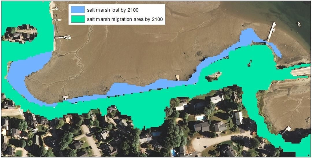
Map info: The map shows existing (2014) salt marsh along New Castle Avenue in Portsmouth NH and area where marsh would hypothetically migrate to by 2100 assuming a high scenario of 2 meters of sea-level rise and no barriers (walls, road) impeding migration. Map...
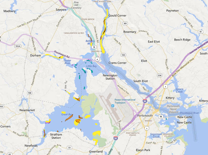
Map info: This map shows oyster area lost since 1982 (yellow), existing natural oyster beds (orange), oyster restoration areas (purple), and oyster farms (turquoise). Map created by Kirsten Howard in October 2015 using the NH Coastal Viewer. Coastal Viewer data layers...
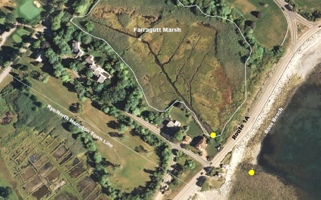
Map info: Bass Beach and Farragut Marsh (outlined in white), divided by Route 1A. The yellow dots mark the approximate location of the culvert, where water flows between the beach and marsh under 1A. Map created by Brendan Newell on 6/29/15 using the NH Coastal...